The GPS Interference Testing may lead to unreliable or unavailable GPS signals in the designated area during the testing.
UPDATE 12-9-26: FAA Adds More GPS Interference Testing for Las Vegas, NV
The FAA has posted another flight advisory for additional GPS Interference Testing around the Las Vegas, NV area. The testing will be happening during the dates and time periods and around the area specified below. During the period of testing, the FAA has said pilots may receive either an unreliable GPS signal or no GPS signal at all. As with their past advisories, the FAA says that pilots should report anomalies “only when ATC assistance is required.”
Las Vegas, NV – December 2016 GPS Interference Testing Advisory
Where’s the testing area?
The location is centered at 373832N1160400W or the BTY VOR 019 degree radial at 60NM.
What times and dates will the testing take place?
- December 11th – 19th, 2016 – 1830Z – 2230Z
As they have in the past, the FAA specifies that the testing may last the entire outlined period of time.
NOTAM Information
- NOTAM INFO: NAV (NTTR GPS 16-12) GPS (INCLUDING WAAS, GBAS, AND ADS-B) MAY NOT BE AVBL WI A 524NM RADIUS CENTERED AT 373832N1160400W (BTY 019060) FL400-UNL DECREASING IN AREA WITH A DECREASE IN ALT DEFINED AS:
- 494NM RADIUS AT FL250
- 437NM RADIUS AT 10000FT
- 405NM RADIUS AT 4000FT AGL
- 337NM RADIUS AT 50FT AGL
Final Details
For pilots planning to fly in the area above during the testing period, the FAA says you should check the NOTAMs frequently, as they can change with little or no notice. To read the FAA advisory for the Las Vegas testing, with an area map graphic, click here.
UPDATE 12-5-16: More FAA GPS Interference Testing for Barstow, CA, Sierra Vista, AZ
The FAA has posted another pair of flight advisories for additional GPS Interference Testing around the Barstow, CA and Sierra Vista, AZ areas. The testing will happen during the dates and time periods and around the area specified below. During the period that the testing is taking place, the FAA has said pilots may receive either an unreliable GPS signal or no GPS signal at all. As with their past advisories, the FAA says that pilots should report anomalies “only when ATC assistance is required.”
Barstow, CA – December 2016 GPS Interference Testing Advisory
Where’s the testing area?
The location is centered at 351509N1164111W or the HEC VOR 325 degree radial at 29NM.
What times and dates will the testing take place?
- December 5th – 6th, 2016 – 2100Z – 2359Z
Per usual, the FAA specifies that the testing may last the entire outlined period of time.
NOTAM Information
- NOTAM INFO: NAV (NTC GPS 16-11) GPS (INCLUDING WAAS, GBAS, AND ADS-B) MAY NOT BE AVBL WI A 18NM RADIUS CENTERED AT 351509N1164111W (HEC 325029) FL400-UNL INCREASING IN AREA WITH A DECREASE IN ALT DEFINED AS:
- 19NM RADIUS AT FL250
- 19NM RADIUS AT 10000FT
- 19NM RADIUS AT 4000FT AGL
- 23NM RADIUS AT 50FT AGL
Sierra Vista, AZ – December 2016 GPS Interference Testing Advisory
Where’s the testing area?
The location is centered at 314817N1091130W or the SSO VOR 162 degree radial at 28NM.
What times and dates will the testing take place?
- December 6th – 7th, 2016 – 0530Z – 1030Z
- December 8th, 2016 – 0730Z – 1030Z
- December 9th, 2016 – 0530Z – 1030Z
Per usual, the FAA specifies that the testing may last the entire outlined period of time.
NOTAM Information
- NOTAM INFO: NAV (EPG GPS 16-02) GPS (INCLUDING WAAS, GBAS, AND ADSB) MAY NOT BE AVBL WI A 496NM RADIUS CENTERED AT 314817N1091130W (SSO 162028) FL400-UNL DECREASING IN AREA WITH A DECREASE IN ALT DEFINED AS:
- 450NM RADIUS AT FL250
- 381NM RADIUS AT 10000FT
- 362NM RADIUS AT 4000FT AGL
- 343NM RADIUS AT 50FT AGL
Final Details
For pilots planning to fly in either of the two areas above during the testing periods, the FAA says you should check the NOTAMs frequently, as they can change with little or no notice. To read the FAA advisory for the Barstow testing, with an area map graphic, click here, and for the Sierra Vista testing with an area map graphic, click here.
UPDATE 12-1-6: FAA Advises of Coastal GPS Interference Testing near Charleston, SC
The FAA has posted another flight advisory for upcoming coastal GPS Interference Testing around the Charleston, SC area. The testing will happen during the dates and time periods and around the area specified below. During the period that the testing is taking place, the FAA has said pilots may receive either an unreliable GPS signal or no GPS signal at all. As with their past advisories, the FAA says that pilots should report anomalies “only when ATC assistance is required.”
Charleston, SC – December 2016 GPS Interference Testing Advisory
Where’s the testing area?
The location is centered at 321000N0794000W or the Charleston VORTAC (CHS) 137 degree radial at 48NM.
What times and dates will the testing take place?
- December 4th, 2016 – 1200Z – 2100Z
- December 7th, 2016 – 1600Z – 2100Z
- December 9th, 2016 – 0100Z – 0800Z and 1200Z – 1700Z
- December 10th, 2016 – 1200Z – 1600Z
- December 13th, 2016 – 1500Z – 2000Z
Per usual, the FAA specifies that the testing may last the entire outlined period of time.
NOTAM Information
- NOTAM INFO: NAV (CSG4 GPS 16-05) GPS (INCLUDING WAAS, GBAS, AND ADS-B) MAY NOT BE AVBL WI A 294NM RADIUS CENTERED AT 321000N0794000W (CHS 137048) FL400-UNL DECREASING IN AREA WITH A DECREASE IN ALT DEFINED AS:
- 248NM RADIUS AT FL250
- 180NM RADIUS AT 10000FT
- 134NM RADIUS AT 4000FT AGL
- 071NM RADIUS AT 50FT AGL
Final Details
For pilots planning to fly in the coastal Charleston area mentioned above, the FAA says you should check the NOTAMs frequently, as they can change with little or no notice. To read the FAA advisory for the Charleston testing, with an area map graphic, click here.
UPDATE 11-28-16: FAA Advises of GPS Interference Testing for the Las Vegas, NV Area
The FAA has posted another flight advisory for upcoming GPS Interference Testing in the Las Vegas, NV area. The testing will happen during the dates and time periods and around the area specified below. During the period the testing is taking place, the FAA says pilots may receive either an unreliable GPS signal or no GPS signal at all. As with their past advisories, the FAA advises pilots to report anomalies “only when ATC assistance is required.”
Las Vegas, NV – November 2016 GPS Interference Testing Advisory
Where’s the testing area?
The location is centered at 371934N1154249W or the BTY VOR 043 degree radial at 59NM.
What times and dates will the testing take place?
- November 29th, 2016 – 0300Z – 1200Z
- November 30th, 2016 – 0530Z – 1200Z
- December 1st – 3rd, 2016- 0530Z – 1200Z
- December 8th, 2016 – 0530Z – 0730Z
- December 12th – 13th, 2016- 0300Z – 1200Z
- December 14th, 2016 – 0530Z – 1200Z
Per usual, the FAA says testing may last the entire specified period of time.
NOTAM Information
- NOTAM INFO: NAV (NTTR GPS 16-09) GPS (INCLUDING WAAS, GBAS, AND ADS-B) MAY NOT BE AVBL WI A 448NM RADIUS CENTERED AT 371934N1154249W (BTY 043059) FL400-UNL DECREASING IN AREA WITH A DECREASE IN ALT DEFINED AS:
- 383NM RADIUS AT FL250
- 312NM RADIUS AT 10000FT
- 270NM RADIUS AT 4000FT AGL
- 224NM RADIUS AT 50FT AGL
Final Details
For pilots planning to fly in the Las Vegas area mentioned above, the FAA says you should check the NOTAMs frequently, as they can change with little or no notice. To read the FAA advisory for the Las Vegas testing, with an area map graphic, click here.
UPDATE 11-15-16: FAA Advises of GPS Interference Testing in Pearl City, HI Area
The FAA has shared another flight advisory for upcoming GPS Interference Testing in the Pearl City, HI area. The testing will happen during the time periods and around the area specified below. During the testing period, the FAA says pilots may receive either an unreliable GPS signal or no signal at all. As with past advisories, the FAA also advises pilots to report anomalies “only when ATC assistance is required.”
Pearl City, HI – November 2016 GPS Interference Testing Advisory
Where’s the testing area?
The location is centered 212858N1580531W or the HNL VORTAC 309 degree radial at 14NM.
What times and dates will the testing take place?
- November 17th – 18th, 2016 – 0100Z – 0600Z
Per usual, the FAA says testing may last the entire specified period of time.
NOTAM Information
- NOTAM INFO: NAV (SBHI GPS 16-15) GPS (INCLUDING WAAS, GBAS, AND ADS-B) MAY NOT BE AVBL WI A 014NM RADIUS CENTERED AT 212858N1580531W (HNL 309014) FL400-UNL INCREASING IN AREA WITH A DECREASE IN ALT DEFINED AS:
- 015NM RADIUS AT FL250
- 016NM RADIUS AT 10000FT
- 016NM RADIUS AT 4000FT AGL
- 026NM RADIUS AT 50FT AGL
Final Details
For pilots planning to fly in the area mentioned above, the FAA says you should check the NOTAMs frequently, as they can change with little or no notice. To read the FAA advisory for the Pearl City testing, with an area map graphic, click here.
UPDATE 11-14-16: FAA Advises of GPS Interference Testing for Destin, FL
Another flight advisory from the FAA has been shared for upcoming GPS Interference Testing in the Destin, FL area. The testing will happen during the time periods and around the area specified below. During the testing period, pilots may receive either an unreliable GPS signal or no signal at all. As with the other advisories, the FAA asks that pilots report anomalies “only when ATC assistance is required.”
Destin, FL – November 2016 GPS Interference Testing Advisory
Where’s the testing area?
The location is centered at 303010N0864611W or the CEW VORTAC 197 degree radial at 20NM.
What times and dates will the testing take place?
- November 16th – 18th, 2016 – 0200Z – 0900Z
As always, the FAA says each of these events may last the entire specified period of time.
NOTAM Information
- NOTAM INFO: NAV (GAFC GPS 16-13) GPS (INCLUDING WAAS, GBAS, AND ADSB) MAY NOT BE AVBL WI A 257NM RADIUS CENTERED AT303010N0864611W (CEW 197020) FL400-UNL DECREASING IN AREA WITH A DECREASE IN ALT DEFINED AS:
- 211NM RADIUS AT FL250
- 148NM RADIUS AT 10000FT
- 110NM RADIUS AT 4000FT AGL
- 044NM RADIUS AT 50FT AGL
Final Details
For pilots planning to fly in the areas above, the FAA advises checking the NOTAMs frequently, as they may change with little or no notice. To read the FAA advisory for the Destin testing, with an area map graphic, click here.
UPDATE 11-4-16: More GPS Interference Testing, Fairbanks, AK, Alamogordo, NM
The FAA has posted a flight advisory for additional GPS Interference Testing in the Fairbanks, AK and the Alamogordo, NM areas. During the time periods and in the areas outlined below, the testing may result in pilots either receiving an unreliable GPS signal, or no signal at all. And as with other testing periods, the FAA requests that pilots report anomalies “only when ATC assistance is required.”
Alamogordo, NM – November 2016 GPS Interference Testing Advisory
Where’s the testing area?
The location is centered at 325928N1061655W or the TCS VORTAC 099 degree radial at 53NM.
What times and dates will the testing take place?
- November 7th, 2016 – 0300Z – 1330Z and 2000Z – 2230Z
- November 8th – 11th, 2016 – 2000Z – 2230Z
- November 12th, 2016 – 0530Z – 1330Z and 2000Z – 2230Z
- November 13th – 16th, 2016 – 0300Z – 1330Z and 2000Z – 2230Z
- November 17th – 18th, 2016 – 0530Z – 1330Z and 2000Z – 2230Z
- November 19th, 2016 – 0530Z – 1330Z
- November 29th – 30th, 2016 – 2000Z – 2230Z
As always, the FAA says each of these events may last the entire specified period of time.
NOTAM Information
- NOTAM INFO: NAV (WSMR GPS 16-18) GPS (INCLUDING WAAS, GBAS, AND ADS-B) MAY NOT BE AVBL WI A 542NM RADIUS CENTERED AT 325928N1061655W (TCS 099053) FL400-UNL DECREASING IN AREA WITH A DECREASE IN ALT DEFINED AS:
- 485NM RADIUS AT FL250
- 412NM RADIUS AT 10000FT
- 417NM RADIUS AT 4000FT AGL
- 399NM RADIUS AT 50FT AGL
Fairbanks, AK – November 2016 GPS Interference Testing Advisory
Where’s the testing area?
The location is centered at 644940N1473613W or the FAI VOR 057 degree radial at 11NM.
What times and dates will the testing take place?
- November 9th, 2016 – 1700Z – 1859Z and 1930Z – 2130Z and 2200Z – 2359Z
As always, the FAA says each of these events may last the entire specified period of time.
NOTAM Information
- NOTAM INFO: NAV (FWAK GPS 16-13) GPS (INCLUDING WAAS, GBAS, AND ADS-B) MAY NOT BE AVBL WI A 011NM RADIUS CENTERED AT 644940N1473613W (FAI 057011) FL400-UNL INCREASING IN AREA WITH A DECREASE IN ALT DEFINED AS:
- 012NM RADIUS AT FL250
- 012NM RADIUS AT 10000FT
- 012NM RADIUS AT 4000FT AGL
- 015NM RADIUS AT 50FT AGL
Final Details
The FAA advises pilots planning to fly in the areas above to check the NOTAMs frequently, as they may change with little or no notice. To read the FAA advisory for the Fairbanks Testing, with an area map graphic, click here, and for the Alamogordo Testing, click here.
UPDATE 10-28-16: More GPS Interference Testing for Barstow, Sierra Vista, Twin Falls
The FAA has posted another flight advisory for additional GPS Interference Testing in the Barstow, CA area, as well as advisories for upcoming testing in Twin Falls ID, and Sierra Vista, AZ. During the time periods and in the areas outlined below, the testing may result in pilots either receiving an unreliable GPS signal, or no signal at all. And as with other testing periods, the FAA asks that pilots report anomalies “only when ATC assistance is required.”
Barstow, CA – October 2016 GPS Interference Testing Advisory
Where’s the testing area?
The location is centered around 352301N1163820W or the HEC VOR 333 degree radial at 36NM.
What times and dates will the testing take place?
- October 31st, 2016 – 0430Z – 1330Z
- November 1st – 4th, 2016 – 0931Z – 1330Z
- November 6th, 2016 – 0601Z – 1330Z
According to the FAA, each of these events may last the entire specified period of time. Also, when combined with the previous Barstow advisory viewable below, testing will be happening for this area daily from Oct 29th – Nov 6th.
NOTAM Information
- NOTAM INFO: NAV (NTC GPS 16-10) GPS (INCLUDING WAAS, GBAS, AND ADS-B) MAY NOT BE AVBL WI A 266NM RADIUS CENTERED AT 352301N1163820W (HEC 333036) FL400-UNL DECREASING IN AREA WITH A DECREASE IN ALT DEFINED AS:
- 218NM RADIUS AT FL250
- 143NM RADIUS AT 10000FT
- 151NM RADIUS AT 4000FT AGL
- 106NM RADIUS AT 50FT AGL
Twin Falls, ID – 2016 GPS Interference Testing Advisory
Where’s the testing area?
The location for the testing is centered at 422244N1154513W or the BOI VORTAC 150 degree radial at 73NM.
What times and dates will the testing take place?
- November 1st, 2016 – 1630Z – 2359Z
- November 2nd – 4th, 2016 – 0000Z – 0030Z and 1630Z – 2359Z
NOTAM Information
- NOTAM INFO: NAV (MHRC GPS 16-05) GPS (INCLUDING WAAS, GBAS, AND ADS-B) MAY NOT BE AVBL WI A 506NM RADIUS CENTERED AT 422244N115451W (BOI 150073) FL400-UNL DECREASING IN AREA WITH A DECREASE IN ALT DEFINED AS:
- 444NM RADIUS AT FL250
- 382NM RADIUS AT 10000FT
- 370NM RADIUS AT 4000FT AGL
- 357NM RADIUS AT 50FT AGL
The FAA says that each of these events may last the entire specified period of time.
Sierra Vista, AZ – October 2016 GPS Interference Testing Advisory
Where’s the testing area?
The testing will be centered at 314817N 1091130W or the SSO VOR 162 degree radial at 28NM.
What times and dates will the testing take place?
- November 1st – 5th, 2016 – 0430Z – 0930Z
- November 8th – 11th, 2016 – 0530Z – 1030Z
As above, the FAA has said the testing may last the entire specified block of time.
NOTAM Information
- NOTAM INFO: NAV (EPG GPS 16-01) GPS (INCLUDING WAAS, GBAS, AND ADSB) MAY NOT BE AVBL WI A 496NM RADIUS CENTERED AT 314817N1091130W (SSO 162028) FL400-UNL DECREASING IN AREA WITH A DECREASE IN ALT DEFINED AS:
- 450NM RADIUS AT FL250
- 381NM RADIUS AT 10000FT
- 362NM RADIUS AT 4000FT AGL
- 343NM RADIUS AT 50FT AGL
Final Details
The FAA advises pilots that are planning operations in these areas to check the NOTAMs frequently, as they may change with little or no notice. To read the FAA advisory for the additional Barstow Testing, with an area map graphic, click here, for the Twin Falls, ID advisory with map graphic, click here, and for the Sierra Vista, AZ advisory with map graphic, click here.
UPDATE: 10-26-16 The GPS Interference Testing for the Barstow area will happen over three days.
The FAA has posted another flight advisory letting pilots know that there will also be some GPS Interference testing going on in the Barstow, CA area. During the time periods and in the areas outlined below, the FAA says that the testing may result in either pilots receiving an unreliable GPS signal, or not receiving a GPS signal at all. As before, FAA is saying pilots should report anomalies “only when ATC assistance is required.”
Barstow, CA – October 2016 GPS Interference Testing Advisory
Where’s the testing area?
- The area will be centered around 352301N1163819W or the HEC VOR 333 degree radial at 36NM.
What times and dates will the testing take place?
- October 29th, 2016 – 0430Z – 1330Z
- October 30th, 2016 – 0430Z – 1330Z
- November 5th, 2016 – 0930Z – 1330Z
According to the FAA, each event may last the entire specified period of time.
NOTAM Information
- NOTAM INFO: NAV (NTC GPS 16-09) GPS (INCLUDING WAAS, GBAS, AND ADS-B) MAY NOT BE AVBL WI A 032NM RADIUS CENTERED AT 352301N1163819W (HEC 333036) FL400-UNL DECREASING IN AREA WITH A DECREASE IN ALT DEFINED AS:
- 032NM RADIUS AT FL250
- 032NM RADIUS AT 10000FT
- 031NM RADIUS AT 4000FT AGL
- 033NM RADIUS AT 50FT AGL
As before, the FAA says the NOTAMs discussed in the advisories may change with little or no notice, and pilots should check the NOTAMs frequently, especially before operation into these areas. To read the FAA advisory for the Barstow Testing, with an area map graphic, click here.
Original Post: 10-19-16 FAA Issues GPS Interference Testing advisories for the Fort Greely, AK and Fallon, NV areas.
The FAA has posted a pair of flight advisories to make pilots aware of some upcoming GPS Interference testing. During the time periods outlined and in the areas outlined below, the FAA says that the testing may result in an unreliable or unavailable GPS signal. In addition, during these periods, the FAA in encouraging pilots to report anomalies only when they require the assistance of ATC.
Fort Greely, AK – October 2016 GPS Interference Testing Advisory
Where’s the testing area?
- The area will be centered at 634944N 1454511W or the BIG VOR 161 degree radial at 11NM.
What times and dates will the testing take place?
- October 19th, 2016 – 1900Z – 2400Z
- October 20th, 2016 – 0001Z – 0700Z
NOTAM Information
- NOTAM INFO: NAV (FGAK GPS 16-14) GPS (INCLUDING WAAS, GBAS, AND ADS-B) MAY NOT BE AVBL WI A 041NM RADIUS CENTERED AT 634944N1454511W (BIG 161011) FL400-UNL DECREASING IN AREA WITH A DECREASE IN ALT DEFINED AS:
- 041NM RADIUS AT FL250
- 041NM RADIUS AT 10000FT
- 039NM RADIUS AT 4000FT AGL
- 039NM RADIUS AT 50FT AGL
Fallon, NV – October 2016 GPS Interference Testing Advisory
Where’s the testing area?
- The area will be centered at 393835N1174702W or the MVA VORTAC 356 degree radial at 66 NM.
What times and dates will the testing take place?
- October 21st, 2016 – 1800Z – 2000Z and 2030Z – 2200Z
- October 25th, 2016 – 1630Z – 1730Z and 2030Z – 2200Z
- October 31st, 2016 – 1630Z – 1730Z
- November 8th, 2016 – 0330Z – 0429Z and 1730Z – 1830Z
- November 9th, 2016 – 0330Z – 0429Z and 1730Z – 1830Z and 2245Z – 2359Z
- November 10th, 2016 – 0000Z – 0015Z
According to the FAA, each event will last the entire requested period.
NOTAM Information
- NOTAM INFO: NAV (NAWDC GPS 16-06) GPS (INCLUDING WAAS, GBAS, AND ADSB) MAY NOT BE AVBL WI A 396NM RADIUS CENTERED AT 393835N1174702W (MVA 356066) FL400-UNL DECREASING IN AREA WITH A DECREASE IN ALT DEFINED AS:
- 341NM RADIUS AT FL250
- 263NM RADIUS AT 10000FT
- 264NM RADIUS AT 4000FT AGL
- 246NM RADIUS AT 50FT AGL
Final Details
The FAA says the NOTAMs discussed in the advisories may change with little or no notice, and that pilots should check NOTAMs frequently for any possible changes before operation into these areas. The FAA says NOTAMs will be published at least 24 hours in advance of any additional GPS tests. If you want to read the FAA advisory for the Fort Greely Testing, with an area map graphic, click here, and for the Fallon, NV advisory with map graphic, click here.





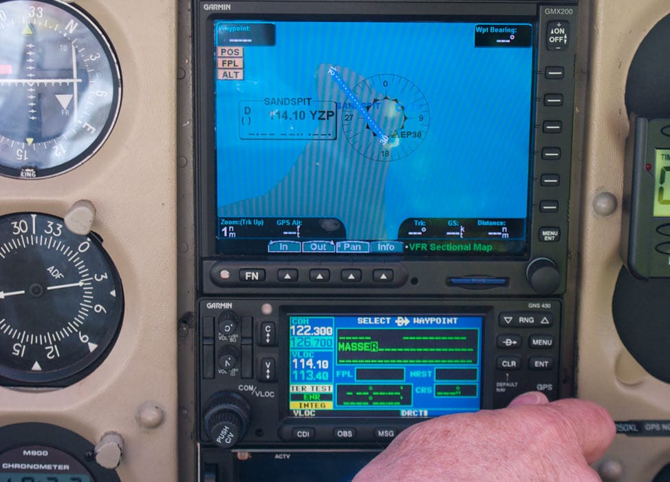



Wait a damn minute! The FAA “doesn’t want to hear about screwed-up GPS signals ONLY if you require assistance from ATC? What if one misses an obscure NOTAM advising that NAS China Lake is nuking GPS signals in the vicinity of an airport where you’re shooting a GPS approach with no radar coverage and maybe no communications (i.e., “..Call FSS when on the ground to cancel..”) Will you even know if you need ATC help? You may not know that you need to go missed if the needles are centered but you didn’t notice the flag.